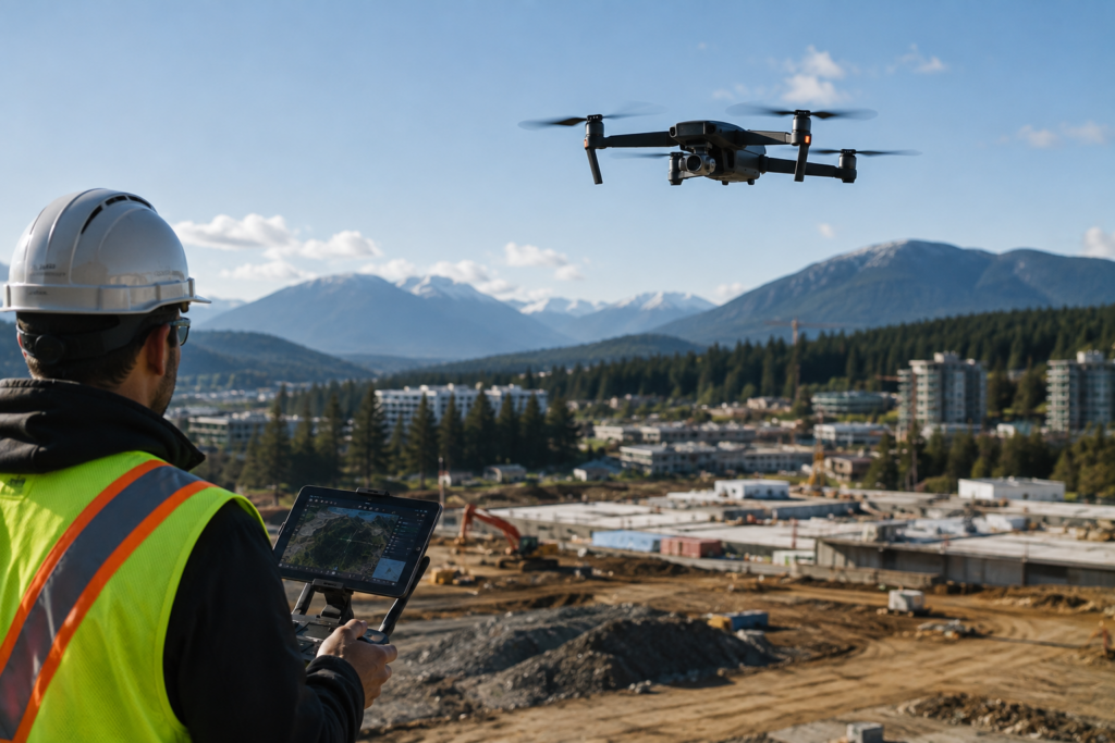
A construction site can change between two survey visits. A landslide can happen before the next inspection. A large parcel of land can take hours to document from the ground.
That is where a drone becomes more than a camera.
With the right sensors, flight plan and processing software, a drone can capture hundreds or thousands of images that are converted into orthomosaics, 3D models, point clouds and elevation data. GIS can then place that information on a map and turn aerial images into something professionals can measure, compare and use for decisions.
For anyone exploring drone mapping in Canada, the interesting part is not flying the aircraft. It is what happens to the data after the flight.
What is drone mapping and how does it work?
Drone mapping, also called UAV mapping or aerial mapping, uses a remotely piloted aircraft to collect geospatial information from above.
A typical workflow looks like this:
Plan the flight → capture imagery → process the images → create a map or 3D model → analyse the data in GIS.
During a mapping mission, the drone follows planned flight lines while its camera or another sensor captures overlapping images. Software can then stitch those images together and create products such as orthophotos, elevation models and 3D representations.
Statistics Canada specifically recognizes geospatial image acquisition, orthophoto processing, elevation and terrain modelling, photomosaics and photogrammetric mapping as parts of Canada’s surveying and mapping industry.
So drone mapping is not simply taking aerial photographs. It is a data-collection method within a much larger geospatial workflow.
How does Drone GIS turn aerial images into useful information?
A drone can show you what a site looks like.
GIS can help you understand what that information means spatially.
For example, a construction company could capture a site before work begins and later compare another drone survey against the original data. A GIS professional can organise layers showing site boundaries, roads, drainage, elevation, utilities or other relevant geographic information.
Natural Resources Canada defines geomatics as the gathering, storing, processing, modelling, analysing and delivery of location-based information. Its federal geomatics work brings together mapping, Earth observation, spatial data and positioning technologies.
This is why the combination of drone to Map GIS is becoming useful. The drone collects the raw spatial information. GIS provides the environment for organising, analysing and presenting it.
Where is drone surveying being used in Canada?
The Canadian use cases are much broader than construction.
| Industry | How drone mapping can be used |
| Construction | Site progress, terrain models, measurements and project documentation |
| Surveying | Aerial imagery, photogrammetry and survey support |
| Land planning | Existing-site conditions, terrain and spatial analysis |
| Mining & energy | Site inspection, terrain information and infrastructure monitoring |
| Environment | Wetlands, erosion, vegetation and natural-hazard monitoring |
| Forestry | Forest condition, terrain and landscape information |
| Emergency response | Rapid aerial information after floods, landslides or other events |
Natural Resources Canada reports that drones are being tested and used for applications including bank erosion, permafrost mapping, thermal imaging and LiDAR-based elevation models.
Transport Canada has also used drones for mapping, ice and oil-spill surveys, pipeline surveys, marine safety and environmental protection.
That gives aerial mapping in Canada a practical role across industries that work with land, infrastructure and natural resources.
Why is drone mapping useful for construction and surveying?
The biggest advantage is not simply speed. It is the ability to collect detailed information over an area without putting people everywhere on the ground.
Natural Resources Canada notes that drones can reach inaccessible or unsafe locations, collect information faster over large areas and provide detailed data.
Imagine a steep excavation area.
Instead of repeatedly sending workers into difficult terrain simply to document site conditions, a properly planned UAV survey can collect aerial imagery. That information can then be processed into a model that professionals can inspect and compare.
It does not make conventional surveying unnecessary. Legal boundaries, control points, accuracy requirements and professional survey responsibilities still matter.
Rather, Drone Surveying Canada is another tool in the surveying and geospatial toolbox.
Do you need to understand Canadian drone regulations?
Absolutely.
A mapping professional cannot treat a commercial drone like a camera with wings.
Transport Canada’s current RPAS framework includes different operating categories and requirements, with rules applying according to factors such as aircraft characteristics, operation type and airspace.
Transport Canada also advises drone pilots to identify controlled or restricted airspace and check relevant aviation information before operating.
The National Research Council’s Drone Site Selection tool helps operators identify areas where drone flights may be prohibited, restricted or require permission.
For anyone considering a drone mapping course in Canada, learning the technology without learning the Canadian operating framework would leave a major gap.
What skills are useful for a career in drone mapping and geospatial technology?
You do not need to become an expert in everything at once.
A strong foundation can include:
- Drone and flight-planning fundamentals
- Photogrammetry
- GIS software and spatial analysis
- Coordinate systems and georeferencing
- GPS and positioning
- Orthomosaic and 3D-model processing
- LiDAR and remote sensing concepts
- Data collection and quality control
- Map creation and interpretation
- Canadian RPAS regulations
- Basic surveying principles
Canada’s occupational classification has long included aerial survey, remote sensing, GIS, cartographic and photogrammetric technicians within technical geomatics occupations. These professionals work across government, utilities, mapping, forestry, engineering and consulting.
That is the real career angle behind Geospatial Technology Canada. The opportunity is not just to fly drones. It is to understand spatial data well enough to produce information another professional can actually use.
Is drone mapping a good skill to learn in Canada?
It can be, particularly if you are interested in the intersection of technology, geography, surveying, construction or environmental work.
But there is an important distinction: knowing how to operate a drone is not the same as being a geospatial professional.
The stronger skill combination is drone data collection + GIS + photogrammetry + spatial analysis.
Canada’s 2026 Collaborative Geospatial Strategy also highlights the country’s need to modernize geospatial infrastructure and strengthen the use, integration and governance of spatial information for decision-making.
For students considering this field, that broader capability is worth developing.
Can Multihexa College help you explore a career in this area?
Multihexa is a Canadian career-oriented college with a campus in Vancouver and programs spanning business, artificial intelligence, business administration, and other career-focused areas.
If you are considering a drone mapping course in Canada, review the current Multihexa program catalogue and speak with the counsellor about your interest in GIS, construction, surveying or geospatial technology.
Look for practical exposure to the complete workflow from data capture to spatial analysis.